 Rio Celeste Tours
How to Get to Rio Celeste: Routes, Roads and Times
How to get to Rio Celeste comes down to one road: every visitor enters through the Pilón entrance of Tenorio Volcano National Park, about 20 minutes from the village of Bijagua on a fully paved road. From La Fortuna the drive takes about 1.5 hours each way, from the Guanacaste coast and Liberia about 2 to 2.5 hours, and no reliable public bus makes the trip, so the real decision is between a rental car, a shuttle, or a guided day that carries you door to door. This page walks each route, flags the navigation trap that catches most maps apps, and explains what the last kilometers feel like before you park. If you would rather skip the driving question entirely, the Rio Celeste tours catalog lists every guided option with its pickup zone, and you can see all Rio Celeste tours with prices before you commit to a rental car.
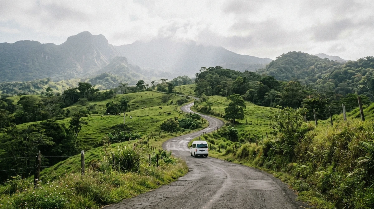
The last stretch is a quiet paved road through ranch country.
Quick answer One paved road, one entrance: 1.5 hours from La Fortuna, 2 to 2.5 from Guanacaste, no bus
Rio Celeste sits inside Tenorio Volcano National Park, and every visitor enters through the Pilón gate near Bijagua de Upala. From La Fortuna, drive Route 142 to El Tanque, then Route 4 north through San Rafael de Guatuso to Samen, then follow the paved park road for the last 19 km, about 1.5 hours in total. From Liberia and the northern Guanacaste resorts, take Route 1 south and then Route 6 to Bijagua, roughly 2 to 2.5 hours. No public bus runs to the entrance, so the realistic options are your own car, a shuttle, or a guided tour with transport included.
Key takeaways
- No car? The full-day tour from La Fortuna handles the whole road question for $89
- The park entrance ticket only makes sense with your own wheels: check the routes first
- How hard the trail is decides what time you want to arrive, and mornings win
The Short Answer
Rio Celeste is not a roadside stop. The river runs inside Tenorio Volcano National Park, and the park has exactly one visitor entrance, called Pilón, which sits about 20 minutes beyond Bijagua de Upala at the end of a paved but narrow road. Every route below ends at that gate.
| Starting point | Distance and time | Best route |
|---|---|---|
| La Fortuna | about 1.5 hours each way | Route 142, then Route 4 north to Samen, then the park road |
| Liberia | about 2 hours | Route 1 south, Route 6 to Bijagua, then the park road |
| Guanacaste resorts (Tamarindo, Conchal, Coco) | 2 to 2.5 hours | Route 1 and Route 6 via Belen or Canas |
| San Jose | 3.5 to 4 hours, longer with traffic | Route 1 north to Canas, then Route 6 to Bijagua |
Two facts frame the whole journey. First, the road is fully paved, so a 4x4 is unnecessary, though the last stretch is steep in places, slick after rain, and crosses one-lane bridges where you yield. Second, entry slots are capped daily and the window runs from 8 a.m. to 2 p.m., so the drive plan needs to land you at the gate with time to spare.
From La Fortuna by Car
The La Fortuna run is the classic day trip: about 1.5 hours each way through some of the prettiest driving in northern Costa Rica. Leave town on Route 142 toward El Tanque, then pick up Route 4 north. You stay on Route 4 for roughly 40 km, rolling through pasture with volcano views, passing through San Rafael de Guatuso, and continuing to an area called Samen.
At Samen, a sign for Tenorio Volcano National Park marks a left turn onto the paved road that runs the final 19 km to the entrance.
- Route 142 from La Fortuna toward El Tanque
- Route 4 north for about 40 km, through San Rafael de Guatuso to Samen
- Left at the Tenorio Volcano National Park sign at Samen
- 19 km of paved park road to the Pilón entrance
The drive is longer than the map suggests in the wet season, because afternoon rain slows the last stretch and the one-lane bridges add waiting time. Leaving La Fortuna by 6:30 to 7:00 am puts you at the gate near the 8 a.m. opening, which is exactly where you want to be: the color reads best before the afternoon sediment arrives, and the trail is at its emptiest.
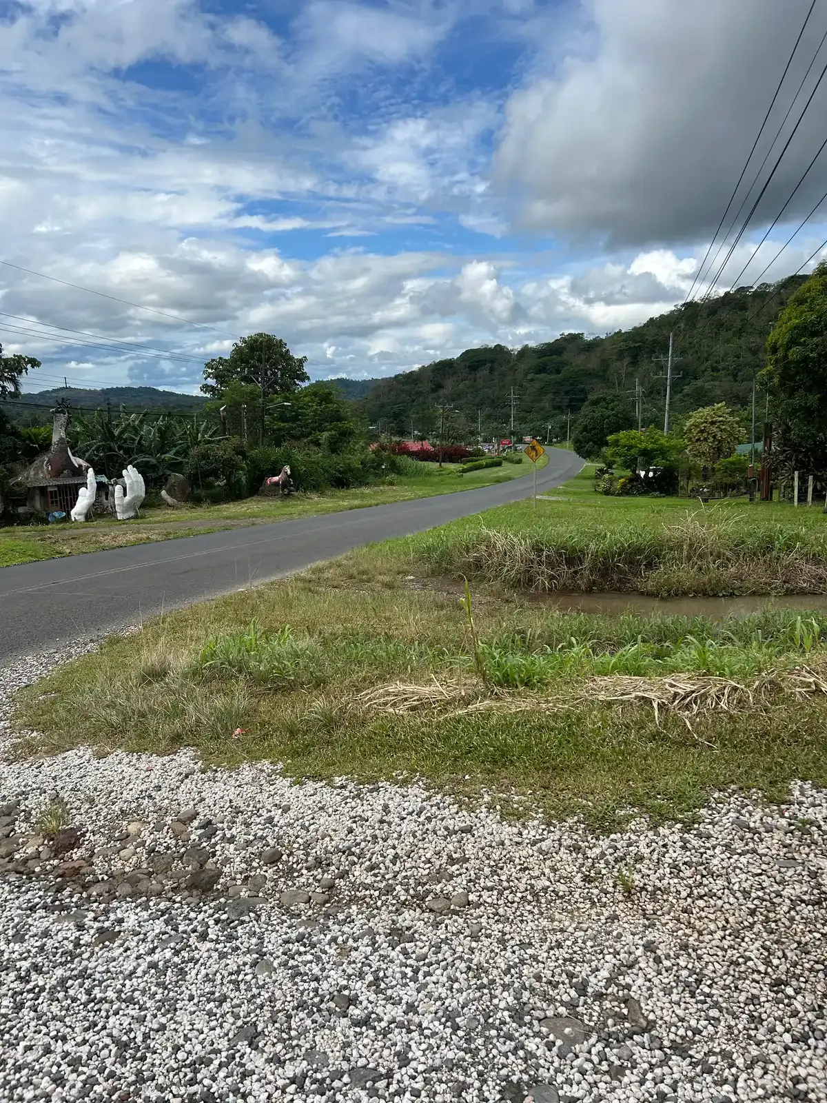
Route 6, the Guanacaste approach toward Bijagua. Photo: Cuban Boy, CC0, via Wikimedia Commons
From the Guanacaste Coast and Liberia
From Liberia and the northern resorts, the approach runs south on the Interamericana (Route 1). Leave the highway about 6 km before Canas and cross over to Route 6 toward Upala. Route 6 climbs through green hills for about 22 km to the small town of Bijagua, where a right turn at the park sign starts the final paved run to the gate.
Count roughly 2 hours from Liberia and 2 to 2.5 hours from the resorts strung along the coast, which is why nearly every Guanacaste listing in this comparison starts its pickups before 7 am.
- Route 1 south from Liberia
- Exit onto Route 6 toward Upala about 6 km before Canas
- 22 km on Route 6 to Bijagua
- Right at the park sign, then the paved road to the entrance
Resort guests without a rental car should look closely at the triple-stop day from Guanacaste, which collects travelers at the hotel gates and folds the two-and-a-half-hour drive into a three-stop day. The self-drive meet-up option on the same listing starts at Llanos de Cortes at 9:00 am, which shortens the morning for confident drivers.
Shuttles, Tours and the No-Car Route
There is no dependable public bus to the park entrance. Buses serve Bijagua village on some schedules, but the last 20 minutes of road have no regular service, and relying on a taxi rank in Bijagua is a gamble rather than a plan. That leaves three realistic ways in without your own car.
- A guided day tour with hotel transport: the full-day listing from La Fortuna and the triple-stop day from Guanacaste both include the road
- A private shuttle, booked from La Fortuna or Liberia, priced per vehicle rather than per person
- A rental car for a day, which also unlocks the self-guided ticket at a third of the price of a guided listing
The math is blunt. A guided day from La Fortuna costs $89 per person with the entry fee, lunch and the road included. A rental car for the day plus the $32 reserved ticket can undercut that for two or more travelers, but only if one of you wants to drive mountain roads for three hours round trip.
Solo travelers usually come out ahead on the guided listing.
The Waze Trap and the Last Kilometers
Set your map app to the park entrance, not to the river, and then override it once. Navigation apps frequently route a left turn too early off Route 4 near San Rafael de Guatuso, onto the old access road that people used before the current one was paved. The old road still exists, and it is much slower.
Stay on Route 4 until Samen, then turn at the park sign.
- Do not turn left immediately after San Rafael de Guatuso, even if the app insists
- Continue to Samen and take the signed turn
- Follow the paved road about 19 km, ignoring smaller tracks that branch off
The final kilometers are narrow and rural: fences, cattle, a school crossing or a herder can hold you up for a minute, and the one-lane bridges require a yield. There is parking at the entrance area, and the ticket office sits before the trailhead. Arrive with your reserved ticket already bought, because in-person sales at the gate are not guaranteed and dry-season mornings do sell out.
What the Road Actually Feels Like
The first hour from either side is ordinary Costa Rican highway: asphalt in variable condition, passing trucks, and a sugar-cane or dairy landscape that changes character as the volcanoes rise. The transition point is the turn at Samen from the La Fortuna side, or the park sign in Bijagua from the south: the road narrows to a single paved lane with pull-outs, fences press close, and the forest starts to close overhead. For the last twenty minutes you are driving through farmland where horses and cattle graze to the fence line, and the volcano hides and reveals itself across the gaps.
- Highway legs: two lanes, ordinary traffic, fuel and food available
- The turn: signed for Tenorio Volcano National Park on both approaches
- The last 19 to 20 km: narrow paved lane, one-lane bridges, farm traffic
- The gate: parking, ticket check, and the trailhead on foot
Drive it in daylight. The road carries no lighting, the bridges are blind, and a horse trailer met at dusk on a one-lane span is the kind of story you tell rather than enjoy. This is the single biggest argument against the late-afternoon return in the wet season, when darkness arrives close to six.
The Times at a Glance
Times below assume normal daylight driving in a private car, read from the park's access information and recent visitor reports. Add twenty to forty minutes in heavy holiday traffic or after an afternoon downpour.
| From | Drive time | Leave by | Why |
|---|---|---|---|
| La Fortuna | about 1.5 hours | 6:30 to 7:00 am | For the 8 a.m. entry and the calmest trail |
| Liberia | about 2 hours | 6:00 am | Beats coast traffic and reaches the gate at opening |
| Tamarindo and Conchal | 2 to 2.5 hours | 5:45 to 6:00 am | The resort pickups run this early for a reason |
| San Jose | 3.5 to 4 hours | before 5:00 am | A long day; many travelers overnight instead |
The return leg deserves its own note: whatever the departure side, the drive back in the dark is the part of the day travelers remember worst. If your visit runs late, stop for dinner in Bijagua or at the hot springs outside La Fortuna and let the traffic and the dark pass.
Fuel, Cash and the Small Print of the Drive
Three practicalities cover most of the drive's small print. Fuel up before the turn: the last stretch toward the park has no stations, and the range math is unforgiving if you also plan a detour to Llanos de Cortes on the way home. Carry some cash in small bills, because the roadside stops and the Bridge-area vendors are cash-first, and card terminals in the countryside fail when the rain arrives.
And photograph the car at pickup, because rental desks in La Fortuna keep short hours and a timestamped photo settles any dispute about scratches.
- Fuel: full tank before the turn at Samen or in Bijagua
- Cash: small bills for roadside stops and parking
- Documents: passport copy for the park gate, licence and rental papers in the glovebox
- Timing: no night driving on the park road, whatever the season
The road's one-lane bridges deserve their own sentence. Traffic yields one direction at a time, the custom is for the later arrival to wait, and a friendly hazard flash settles any ambiguity. School mornings bring foot traffic near Bijagua, and afternoon rain brings motorcyclists riding the painted lines.
None of it is difficult; all of it rewards a driver in no hurry.
Which Entrance Road, and What People Get Wrong
Three mistakes account for nearly every bad drive to Rio Celeste. The first is the Waze trap covered above, a left turn onto the old Guatuso road that adds close to an hour of rough going. The second is arriving at Bijagua village and stopping there, assuming the town is the destination: the park gate is twenty minutes further on a signed road, and travelers who wait in town lose their morning slot.
The third is planning the visit as a stop between two other stops: the loop plus the drive is a full day, and the travelers who enjoy it most treat the park as the day's only appointment.
- Wrong turn at Guatuso: stay on Route 4 to Samen
- Stopping in Bijagua: the gate is 20 minutes further, signed all the way
- Overloaded itineraries: give the park the whole day, not an hour
One more that deserves its own note: arrival time. The entry window closes at 2 p.m., and the gate honors reservations, not intentions. A 1 p.m. arrival with a reserved ticket still works, but it hands you a hot, crowded trail with the color at its worst, and it makes the drive home an evening drive.
Every hour earlier is a better visit, which is why this page keeps saying the same thing in different ways: leave early.
Tours Versus Self-Drive: The Price Comparison
Strip the day to its parts and the decision writes itself. The road is 1.5 hours each way from La Fortuna, the trail is 2.5 to 4 hours, and lunch is a necessity rather than an option. A self-drive visitor supplies the driving, the navigation and the timing, and buys only the entry: about $13.56 with tax direct, or $32 reserved through the listed ticket.
A guided visitor hands over all of it: the road, the timing, the interpretation and the meal, for $89 and up. Neither answer is wrong, and the honest divider is a single question: does one of you want to drive mountain roads for three hours on your day off?
| Decision | Self-drive | Guided day |
|---|---|---|
| The road | You drive it, both ways | Handled, door to door |
| The entry | Reserved ticket, $32, or about $13.56 direct | Included in the price |
| The trail | Your own pace, no interpretation | Guide, wildlife spotting, lunch |
| The flexibility | Total: weather, timing, detours | Fixed departure, fixed stops |
Figures current for Q3 2026.
The Trail at the End of the Road
The drive delivers you to a loop of roughly 3.5-4 km, and the walkable standard route takes most visitors 2.5-4 hours with stops. The flat, paved first stretch ends at a long staircase with a railing that drops to the waterfall lookout, which is the moment the day is measured against. Remember what the road rules already told you: Swimming is prohibited inside the park, so the staircase ends in a lookout, not a pool ladder.
The chemistry worth knowing before you go: at Los Teñideros, sulfur meeting calcium carbonate scatters light into the opaque sky blue the drive is famous for. And the same road notes carry a weather warning: heavy rain turns the river green-brown within hours, because suspended sediment overwhelms that scattering. A 6 a.m. departure beats both the crowd and the brown.
Getting-There Questions, Answered
How far is Rio Celeste from La Fortuna?
About 1.5 hours each way by road: Route 142 to El Tanque, Route 4 north through San Rafael de Guatuso to Samen, then 19 km of paved park road to the entrance.
Do you need a 4x4 for Rio Celeste?
No. The entrance road is fully paved, and a regular sedan handles it. It is steep in places, slick after rain, and crosses one-lane bridges where you yield.
Is there a bus from La Fortuna to Rio Celeste?
No reliable public bus reaches the park entrance. The realistic options are a rental car, a private shuttle, or a guided day with transport included.
Where do you park for Rio Celeste?
At the Pilón entrance area, about 20 minutes beyond Bijagua on the paved road. Arrive near the 8 a.m. opening on dry-season mornings, when the capped entry slots go first.
Can you visit Rio Celeste without a tour?
Yes, with a reserved ticket and your own car or shuttle. The self-guided loop is signed, and the entrance ticket reserves your slot in advance.
Why do maps send me down a bad road?
Apps often route a left turn too early off Route 4 near San Rafael de Guatuso onto the old access road. Stay on Route 4 to Samen, then turn at the park sign.
Renting a Car for the Trip
A rental car turns Rio Celeste into a half-day drive and a full-day park visit, and the road quality makes it an easy decision: the entire route runs on pavement, and a small 4x2 handles it in any season. Book the car for the full day regardless, because the 1.5-hour legs plus a 3-hour loop leave little slack, and driving the mountain road after dark is the one mistake first-timers consistently make.
- Book a small 4x2, not a 4x4, and save the surcharge
- Plan the rental for a full day, not a half day
- Photograph the car at pickup: the rental desks at La Fortuna keep short hours
- Fuel up in Ciudad Quesada or La Fortuna; the last stretch has no stations
The honest counterpoint: one traveler in your group loses the trail to the wheel, and the one-lane bridges plus school traffic on the park road need a patient driver. Families usually still choose the car, because the flexibility around weather and color is worth more than any guided commentary.
Combining the Drive With Other Stops
The La Fortuna route stacks stops naturally. The road north passes dairy country and the Guatuso side roads, and the return leg can drop into the hot springs outside La Fortuna for the evening, which is the single most popular pairing in the region. From the Guanacaste side, Llanos de Cortes waterfall sits almost exactly on the way, a 20-minute detour that adds a swimmable waterfall to a hike where swimming is banned, and the sloth reserves around Bijagua sit minutes from the park gate.
- La Fortuna side: hot springs on the return leg, Arenal viewpoints on the main road
- Guanacaste side: Llanos de Cortes waterfall, then the sloth reserves at Bijagua
- Both sides: the town of Bijagua itself for a quiet lunch before or after the hike
If the day is meant to be simple, keep it simple: one drive, one loop, one late lunch. The travelers who rate the day highest in recent reviews are consistently the ones who entered at 8 a.m. and let the afternoon take care of itself.